Drought conditions have plagued agriculture in West Virginia’s Eastern Panhandle this summer. While the local status has been reduced to a moderate drought, other regions of the Mountain State now face similarly severe dry spells.
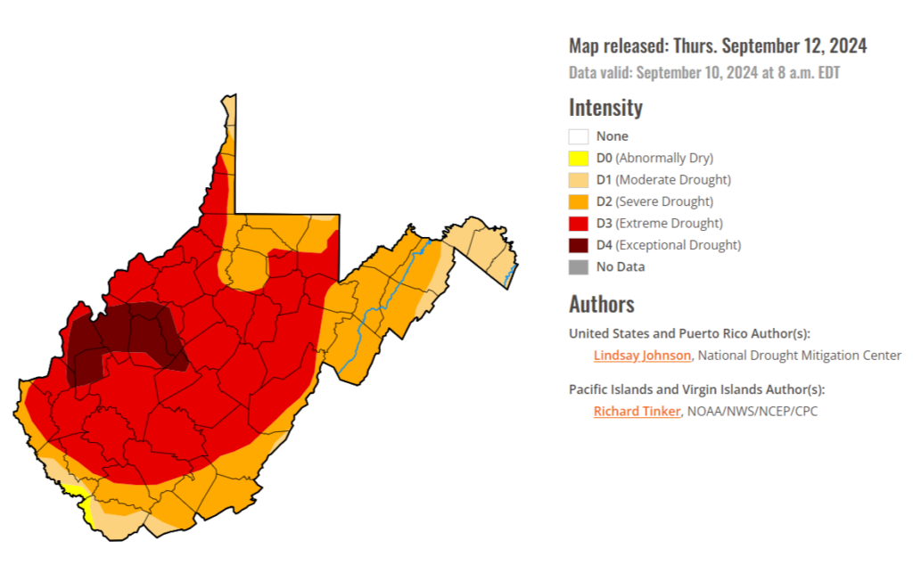
The U.S. Drought Monitor has declared an “exceptional” drought in parts of Braxton, Cabell, Calhoun, Clay, Jackson, Mason, Putnam, Roane and Wirt counties.
Much of the rest of the state is currently facing “extreme” drought conditions, according to the Drought Monitor.
In nearby Nicholas County, officials have enacted water conservation measures for the city of Richwood over concerns that its primary water source, the Cherry River, could run dry.
During a press call Thursday, U.S. Sen. Shelley Moore Capito, R-W.Va. said she would work with the governor’s office if an emergency declaration becomes possible. An emergency declaration would open affected counties to federal aid.
“The drought is top of mind [to] a lot of our farmers,” she said. “But nobody can control the weather. We know that.”
In July, Gov. Jim Justice declared a statewide emergency over the drought, opening the state to an initial round of federal aid.