This is a developing story and may be updated.
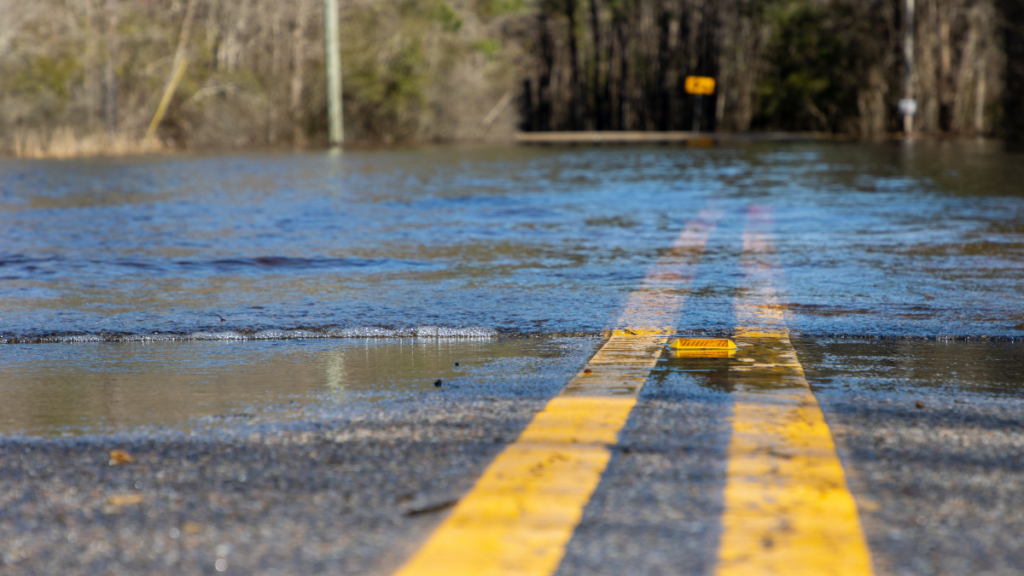
Many of the areas that saw flooding Monday are on track for more rain Tuesday and into the night.
Jennifer Berryman, a meteorologist with the National Weather Service, said light rain is expected thoughout the day in central and southern West Virginia with heavier rain possible into the evening.
The Division of Emergency Management, National Guard, Metro 911, Emergency Operations Center and the National Weather Service are all standing by waiting to see what storms develop and where.
There is a 60-80 percent chance of rain over central, eastern and southern West Virginia. Berryman said that storms are tracking to cross over Charleston up to Clarksburg, and other cells to move over Fayette County down to McDowell County.
She said that the weather service still doesn’t know how much precipitation these fronts will deliver to those areas.
Kanawha County Commissioner Lance Wheeler was at the Emergency Operations Center at Kanawha County Metro 911 Monday and said that those agencies are fully staffed and ready to assist if another heavy rain does cause more flooding.
“The big question is — is the storm front going to move though or is it going to hover over the area and drop a lot of rain?” said Wheeler.
He said after four days of rain the soil is completely saturated.
“The ground can only take so much water,” Wheeler said. “When this rain comes a third time, it’s going to roll right off the hill and it’s going to fill in these valleys and this river, and it’s going to bring that water level even higher. So, what we could see is maybe less rain coming in, but more potential for hazard.”
Wheeler advised residents not to underestimate the potential danger and to have a plan for Tuesday evening if there are more floods.
“So, we told people, take this seriously, this isn’t like your casual floods that you’ve seen in the past. This is the most rain many of these areas have seen in a lifetime,” Wheeler said.
He encouraged residents to listen for flood alert sirens and stay vigilant of any flooding even if it is not yet at the door. He cautioned the water can rise quickly. He also advised to not cross any streams and instead call for a water rescue.
Wheeler said before they can start cleaning up and assessing damage, they are putting resources towards preparedness for another possible heavy rainfall.
West Virginia’s National Guard’s Edwin “Bo” Wriston said they are reaching out to see if they are needed for immediate help but are not doing damage assessments at this time.
Wriston said they are waiting to see what the storm front brings and if the governor calls them back into action.