On this West Virginia Morning, an experimental apple orchard in the state is helping to fight pollution, improve food scarcity and some hope even heal veterans. Briana Heaney has the story.
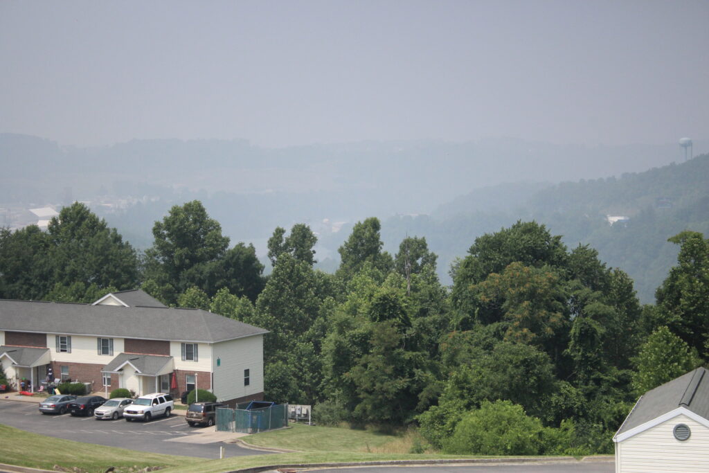
A view over the Monongahela River Valley near Morgantown shows the limited visibility on June 29, 2023.Chris Schulz/West Virginia Public Broadcasting
Listen
Share this Article
Since smoke from Canadian wildfires first descended on West Virginia in early June, residents have become accustomed to AirNow.gov, home of the U.S. Air Quality Index. The site provides up to date information and maps about where wildfire smoke and other pollutants are affecting air quality across the country.
However, often when a West Virginia zip code is entered directly into the search bar at the top of the page, the results can contradict measurements elsewhere on the site and user’s own observations.
Christina Fernandez is the Air and Radiation Division director for the Environmental Protection Agency’s Region Three, which covers West Virginia, as well as Pennsylvania, Maryland, Delaware, Virginia and Washington, D.C.
“When we talk about air quality, there are multiple pollutants,” she said. “We have what we call criteria pollutants, air pollutants, which are for example, particulate matter (PM), ozone, carbon monoxide, nitrogen dioxide, sulfur dioxide, and lead. And then we have air toxics, we have thousands. We have standards and regulations to reduce these pollutants.”
Monitoring for all of these pollutants is ongoing, and each pollutant requires a different type of monitor. Fernandez said that one of the criteria for where to place monitors is population. For the monitoring of particulate matter, which is the primary pollutant being produced by the wildfires, the minimum population criteria is between 500,000 to one million people. On top of low population density, air quality in West Virginia is normally very good, and as a result the state only has 13 monitors that detect particulate matter.
“What’s happening is West Virginia is meeting the PM standard,” Fernandez said. “When a state or an area is meeting the standards, and they’re not under what we call a maintenance plan, the state can remove a monitor, it doesn’t have to have it.”
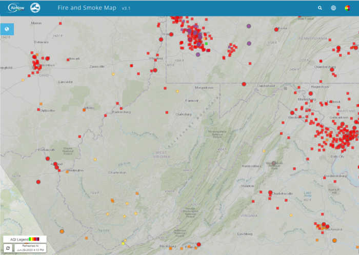
A screenshot of the AirNow Fire and Smoke Map taken Thursday afternoon shows the limited number of monitors in West Virginia compared to in larger cities in surrounding areas.
Renu Chakrabarty is the assistant director for the air monitoring laboratory and air toxics at the Division of Air Quality at the West Virginia Department of Environmental Protection. She said the DEP doesn’t just rely on its own monitors, and works with other departments and states to ensure complete, up-to-date information is available.
“We have a limited budget, and we have to allocate our resources appropriately,” she said. “What we’re looking at is based on what our monitors are actually reading and what monitors in nearby states and bordering areas are reading. We also look at some of the weather forecasts and see how the wind is kind of coming through and impacting.”
Chakrabarty said the incongruous results users may get is an artifact of the way the AirNow system defaults in searches, giving green results based on ozone readings.
“What we are advising folks to do is use the AirNow website, but make sure that you’re using the contours feature from the interactive maps page,” she said. “That will provide you a better picture of what’s going on.”
Chakrabarty advises that like the weather, air quality can change from hour to hour and recommends checking AirNow.gov before going outside.
The state Department of Environmental Protection has filed a motion in federal court to intervene in a proposed settlement to limit mining pollutants in streams.
At the heart of the issue is the Guyandotte River and the alleged failure of the DEP to administer water testing and limits for ionic toxicity in 11 state streams that affect 100,000 people. As a result, conservation groups filed a lawsuit.
The power plant rules align with changes that have been happening in the sector in the past decade. Electric utilities have moved sharply away from coal, largely switching to natural gas.
In Pineville, West Virginia, a town of 500, residents filled up the front rows of the county courtroom recently. They came to hear the latest legal update on a battle some have been fighting for generations - securing clean water. Bobby Lee Keen and his wife Patsy attended the hearing. “How come they have people living like they're in a third world country in the United States of America?” asked Bobby Keen.