W.Va. Analysts Develop New Tech To Visualize Flood Risks

West Virginia geospatial officials are developing new technology to help visualize flood and landslide risk in the state. The project aims to create more accessible and updated community-level flood risk data.

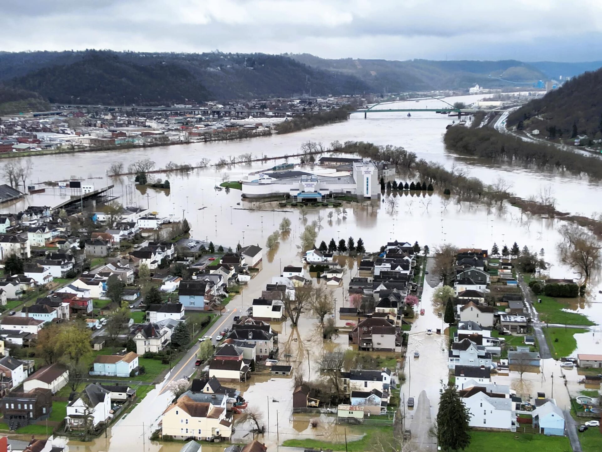
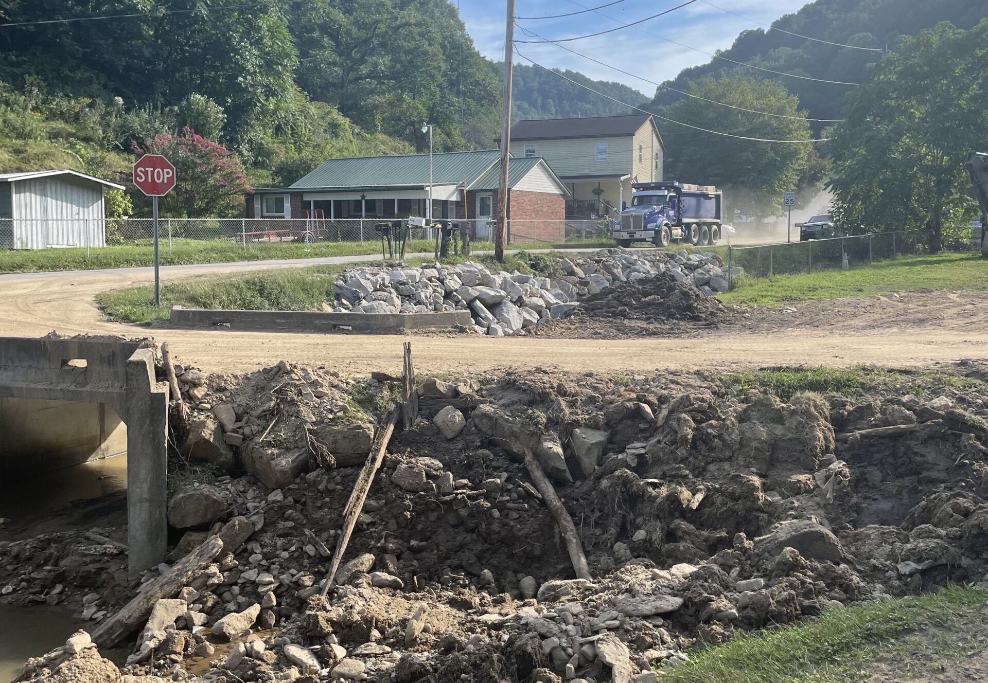
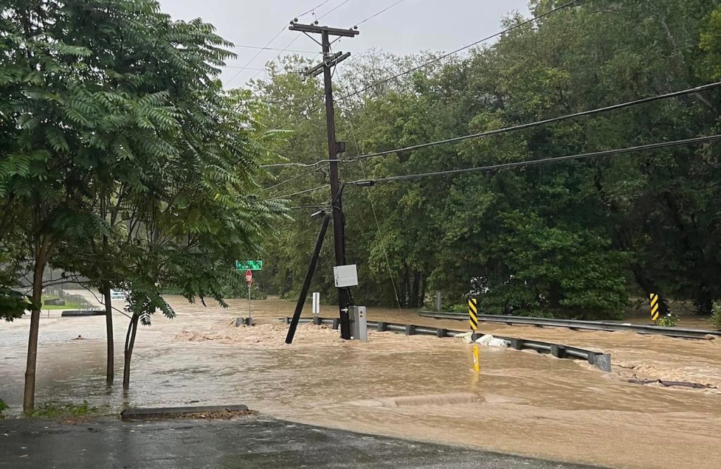
April storms have caused flooding across West Virginia, from the Northern Panhandle to the state capital.

Flooding events like these are familiar territory for many residents. According to the West Virginia GIS Technical Center, 286 communities across the state are located directly on flood plains — areas adjacent to waterways that can become inundated by rising water levels.

The center has long worked to identify flood risks through digital mapping software. On Sunday, state analysts presented new developments in this effort to the West Virginia Legislature’s Joint Legislative Committee on Flooding.

Currently, the center is working to strengthen local flood risk data and to create data visualization tools more easily understood by members of the public, according to Co-Director Aaron Maxwell.

Often, emergency management data comes from the federal level, which limits the level of detail available on the local level.

The center is working to update structural and flood plain data across the state to “support the public and flood plain managers in flood-prone communities,” and to develop a “higher grain of detail than what’s available with federal tools,” Maxwell said.

Last year, the center began developing the West Virginia Flood Resiliency Framework through a grant from the National Science Foundation (NSF). This has allowed the center to develop mapping and modeling tools on flood risk and resiliency across the state, Maxwell said.

Beyond modeling how waterways and properties would be affected by rising water levels, Maxwell said the center is also conducting a statewide survey to assess how residents feel about flood risks and recovery efforts in their community.

The center will then flesh out additional reports on flood risk preparedness locally, Maxwell said.

By providing resources like new data visualization software and survey reports to the public, Maxwell said the center hopes to bolster “data-driven decision-making in the state,” like corroborating emergency relief grant requests with concrete data.

Maxwell also said that the center has been working with West Virginia’s State Resiliency Office to compile these resources into a “one-stop shop for people to go to, to investigate their flood risk.”

This furthers the center’s goals of providing more accessible data for the public. Pulling it all together in one location is easier for every-day residents, like how 3D visualization tools are more easily understood than convoluted or industry-specific information, Maxwell said.

Aaron Maxwell, co-director of the West Virginia GIS Technical Center, speaks to members of the West Virginia Legislature Sunday.

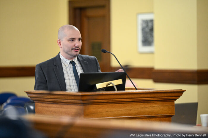
Photo Credit: Perry Bennett/WV Legislative Photography

The center is also working to develop tools that can assess risks associated with flooding, like landslides.

Kurt Donaldson, geographic information system (GIS) manager at the center, said that landslides are the second most costly form of natural disaster to West Virginia, second only to flooding.

“Just where West Virginia is, with the steep slopes, landslides are always an issue,” he said during the committee meeting Sunday. “Sometimes they get categorized as flood-damaged structures when it was associated with a mudslide.”

Donaldson said that the center is developing a state landslide susceptibility grid.

Like the flood risk visualization maps, these aim to convey to local officials and members of the public emergency risks present in their communities. “It can be useful for identifying areas that are susceptible to landslides,” he said.

While the center will continue to work on the project in the coming months, Maxwell said their NSF funding ends in October, requiring sustainable, long-term funding resources to keep data up to date.

Sen. Chandler Swope, R-Mercer, said that flood risk management is often overlooked in financial discussions within the Legislature, which he views as an oversight.

“Flooding has been, in budget terms at least, virtually ignored for 100 years,” he said during Sunday’s meeting. “We’ve got the other highways, water, sewer, broadband, et cetera infrastructure, but flooding is not on our agenda as a major infrastructure need for West Virginia.”

Swope said that he and members of the Legislature should prioritize flood risk mitigation funding in upcoming financial discussions.

“As money becomes available after other infrastructure needs are met, I think we should give serious consideration to doing what we can for flood mitigation, and we’ll choose the highest priority places first,” he said.

Swope also said that preventing damages associated with natural disasters like floods would ultimately limit state spending on emergency response efforts.

“It’s not an expense that wouldn’t pay for itself with the proper application,” he said. “If this information had been available 100 years ago, there might be a lot of towns and cities that have a lot less damages due to floods.”

To participate in the West Virginia GIS Technical Center’s flood resiliency survey, visit the center’s West Virginia Flood Resilience Framework website.

For more information on local flood risk in West Virginia, visit the West Virginia GIS Technical Center’s West Virginia Flood Tool.

This 3D model from the West Virginia GIS Technical Center shows how rising water levels would affect a West Virginia home.

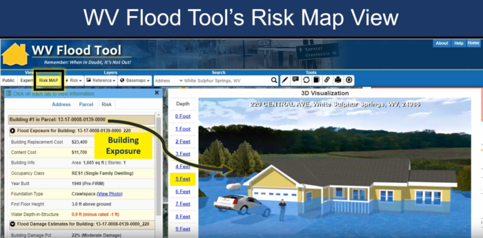
Image Credit: West Virginia Flood Tool/West Virginia GIS Technical Center

Governor Widens State Of Emergency; Storm Clean Up Continues

A total of 26 counties in West Virginia are now under a state of emergency declaration following heavy rains, tornadoes and storms last week, and the heavy rains and storms that hit the state on April 11.

A total of 26 counties in West Virginia are now under a state of emergency declaration following heavy rains, tornadoes and storms last week, and the heavy rains and storms that hit the state on April 11.

Gov. Jim Justice has amended last week’s State of Emergency to include Boone, Braxton, Calhoun, Doddridge, Gilmer, Harrison, Jackson, Logan, Mingo, Ritchie, Roane, Tyler, Wayne and Wirt counties. 

The initial group included Fayette, Kanawha, Lincoln and Nicholas counties on April 2, and then two days later, the governor added Barbour, Brooke, Hancock, Marshall, Ohio, Wetzel, and Wood counties. On April 8, Justice added Pleasants County.

West Virginia Division of Highways (WVDOH) road crews continue to work to assess and clean up damage caused by a massive storm that moved through the state on April 11.
 
Most of the state had been under a tornado watch until 9 p.m. Thursday. Tornadoes did not materialize, but high winds and a largely stationary storm front dumped record amounts of rainfall on the Kanawha Valley and other parts of West Virginia, leading to mud and rock slides, downed trees and flash flooding.

Some parts of the state received five inches of rainfall in the space of several hours.
 
WVDOH Chief Engineer of Operations Joe Pack said the worst of the flooding was concentrated north of Interstate 64. 

As of 2 p.m. Friday, April 12, multiple roads remained closed by high water in Kanawha, Cabell, Jackson, Clay, Mason, Lincoln, Pleasants, Wood, Doddridge, Harrison, Marion, Monongalia, Morgan, Brooke, Marshall, Ohio, Tyler and Wetzel counties.

In Kanawha County, record rainfall overwhelmed storm drains on Interstate 64 near the Greenbrier Street exit, flooding the interstate. WVDOH work crews waded into the rushing water with rakes to clear the drains by hand.

Pack said that, once the water recedes, WVDOH road crews can assess any damage to the roadway and plan any repairs.

The State of Emergency declaration is a proactive measure ensuring the allocation of necessary resources and expediting emergency response efforts. It allows state and local agencies to take swift and decisive actions to mitigate the dangers to protect the lives and property of West Virginians.

Residents are encouraged to remain vigilant and monitor official emergency management and local media accounts for updates.

Last week, Justice issued a State of Preparedness for all 55 counties, which is still in effect.

Important links:

Wheeling Faces Worst Flood In 20 Years, Mayor Says

After a week of inclement weather, the Ohio River is higher in Wheeling than it has been in 20 years.

The Ohio River reached “Moderate Flood Stage” in Wheeling on Thursday, a height of 40 feet. The waters were expected to crest at nearly 42 feet.

Major flooded areas included Water Street at Heritage Port and most of the southern end of Wheeling Island near the Wheeling Island Stadium.

The Mayor of Wheeling, Glenn Elliot told MetroNews “Talkine” that the river last crested this high in 2004, but people who live near the river are accustomed to floods.

Free parking is available to park cars for those in flooded areas in the 10th Street and Intermodal Parking Garage.

According to a release from the City of Wheeling 1-70 Exit 0 and the Bridgeport Bridge will remain open for residents and businesses.

Onlookers in vehicles are being asked to avoid flooded areas.

To prepare for flood cleanup, the Wheeling-Ohio County Health Department offered free tetanus shots Friday for West Virginia residents.

The Ohio River is expected to remain in flood stage across portions of the area through the weekend.

April Showers Could Bring Floods, Help Ebb Fires

The National Weather Service (NWS) has issued a flood watch for the northern two-thirds of the state. The warning extends until Tuesday night with more rainfall and severe weather on the way later in the week. The weather service advises residents to be ready to take action to stay safe. The rainfall could be beneficial, however, for the ongoing fires in the Eastern Panhandle. 

The National Weather Service (NWS) has issued a flood watch for the northern two-thirds of the state. The warning extends until Tuesday night with more rainfall and severe weather on the way later in the week. The weather service advises residents to be ready to take action to stay safe. 

John Peck, a meteorologist at the National Weather Service, said that residents along waterways anywhere within the flood area need to practice heightened caution and awareness. 

“Anybody that’s in those lower lying areas or has interest along creeks, streams and rivers,” Peck said. “Be advised to move any personal property away from those locations.”

The rainfall could be beneficial for the ongoing fires in the Eastern Panhandle

“The rain will help moisten up the fields,” Peck said. “Which will reduce the potential for wildfire spread. And it should help any wildland firefighters take care of any issues that are lingering out there.”

The wet front is expected to waver north to south throughout the week, rendering it hard to know where some of the heaviest rainfall will likely occur. 

“Just important to know that there will be some potential for some heavy rain out there, perhaps some persistent heavy rain for some locations,” Peck said. 

Peck said that as the spring progresses and the larger mountain vegetation, like trees, begin leafing the land will be able to absorb more rain. But now, with only smaller vegetation out of winter dormancy, a lot of the rainfall is still running off the mountain. 

“This early in the season where you don’t have all the vegetation active, it’s relatively easy to get some overland flooding when you get some heavier rainfall,” Peck said. “But we do have the grasses active, that’ll take care of some of it, but the trees are still just coming into their own.”

Less Than Three Weeks Left To Claim Aid For Flood Damages

The deadline to file a federal aid claim over personal property damaged in August 2023 flooding incidents is April 1. West Virginia residents of several counties can receive grants for damages not covered by insurance.

West Virginia residents have until April 1 to claim federal aid for property damages or losses resulting from flash flooding in August 2023.

The Federal Emergency Management Agency (FEMA) announced the deadline for filing claims Wednesday. It applies to residents of Boone, Calhoun, Clay, Harrison and Kanawha counties.

Last summer, flash flooding ravaged homes and businesses across southern and central West Virginia. In January, President Joe Biden declared the incident a major disaster, which allowed residents to claim federal disaster recovery funds through FEMA.

So far, more than $1 million has been allocated to disaster recovery efforts.

FEMA grants do not need to be repaid, and the organization encourages residents to apply for aid even if they have insurance. FEMA does not provide grants for damages covered by insurance, but will subsidize costs not covered through insurance claims.

Although most aid claims focus on structural damages, FEMA can also help cover some specific damages not included in insurance plans. This can include wells, furnaces, private roads, private bridges and septic systems.

For more information on how to file a claim, residents can contact FEMA’s Disaster Assistance Helpline at 1 (800) 621-3362, or visit disaster recovery centers in Boone, Clay, Harrison or Kanawha counties.

To learn more about filing a claim online, visit www.DisasterAssistance.gov.

Warmer Climate In W.Va. Equals More Rainfall And More Floods

Curtis Tate spoke with Nicolas Zegre, an associate professor of forest hydrology at West Virginia University, about what’s behind this trend.

Flood events are becoming more frequent and severe in West Virginia, causing millions of dollars in damage to property, disrupting communities and displacing lives. 

Curtis Tate spoke with Nicolas Zegre, an associate professor of forest hydrology at West Virginia University (WVU), about what’s behind this trend.

This interview has been edited for length and clarity.

Tate: What makes West Virginia and Appalachia so vulnerable to severe, frequent floods?

Zegre: When we think about floods, in particular West Virginia, we have to think about them two ways. One is what we call a riverine based flood. So the larger rivers that flood when they spill over the stream, the riverbanks onto the floodplain, which of course are normally dry areas. And so when we look at flooding in West Virginia and we see that riverine flooding, there are hot spots in the Eastern Panhandle, where we see a lot of that riverine flooding, and that’s associated with the ridge and valley, the large rivers like the Potomac, that the ridge and valley topography kind of creates these really wide river valleys that provide a floodplain and we certainly have that in other parts of the state. But when we think about hot spots in the state, the Eastern Panhandle, the riverine flooding is a big problem. 

But the other type of flooding we’re concerned about in West Virginia is flash flooding. And flash flooding can happen anywhere. It can happen, certainly in our small streams and our heavily dissected headwater valleys where 85 percent of our streams in West Virginia are small streams. And, of course, we know we have people living up and down just about every hollow in West Virginia.

And so we actually have two hot spots, we have a hot spot in the West Fork watershed in that Clarksburg-Bridgeport Harrison County area. And then we also see a flash flooding hot spot kind of central to Kanawha and what we refer to as kind of the southern coalfield counties. Now, that said, flash flooding and riverine flooding does happen everywhere throughout the state. But if we’re thinking about a higher propensity for flash flooding, or for riverine flooding, we do see these emerging trends on where there is a greater probability of them happening.

Tate: So for example, in the 2016 flood disaster in southern West Virginia, was it more the second type?

Zegre: It was actually both. When they started collecting stories of what the 2016 flood looked like, and from the community and the first responder perspectives, and then when we started looking at what the floods look like from a hydrology perspective, what became clear was it was a different type of flood in different parts of the Greenbrier watershed. So around Richwood and Rainelle, for example, that was more a flash flood, a wall of water moving very, very quickly downslope. 

Whereas, when you were in the White Sulphur Springs and kind of Lewisburg area, it was more of a riverine flood, where the water, the river level rose and kind of spilled over and filled the wider valley. And what’s interesting, Curtis, is when you start thinking about where the damage was, and vulnerability, and also recovery, we saw very different damage and very different approaches to response and recovery in Rainelle versus White Sulphur Springs. And we can tie that back to the different types of floods. But I should say that, in the case of the 2016 flood, there were a lot of flash floods that routed downstream that also contributed to the larger riverine flood. And so we can have multiple types of floods occurring in the same event, which is going to be related to the topography and the stream channel and what all that looks like.

Tate: What’s driving the heavier rainfall?

Zegre: So heavy rainfalls are the result of a warmer atmosphere. We think of the atmosphere as like a balloon, and if you blow up the balloon in your house in January, and it’s warm inside your house, the balloon is expanded. And if you walk outside, on that cold winter day, that balloon is going to contract, walk back inside to that warm house and then the balloon is going to expand. So that’s what’s happening with warming temperatures in the atmosphere. 

With a warmer temperature, the atmosphere expands, which means it can store more water. But with warmer temperatures, there’s more evaporation of water from our soils, in our trees and our rivers and our lakes. And so, more water has been put into the atmosphere and more of that water can be stored in the atmosphere. And once the atmosphere reaches saturation, we have these very heavy intense rainfalls, and so heavy rainfall and air temperature is very clearly related. In fact, for a single one degree temperature increase, a one degree Fahrenheit increase in air temperature, the atmosphere can hold 4 percent more water. And so, as the atmosphere warms, that holds more water, and it creates more rainfall. 

Tate: How much does land use, whether commercial, residential or industrial, contribute to the problem?

Zegre: Whether it is, you know, what we would call an old growth forest, or a Walmart parking lot, if you drop eight to 10 inches of rain in a couple of hours, like what was experienced in eastern Kentucky, two summers ago, there’s going to be flooding in it. Our systems just aren’t designed to handle that much water. But land use activities very much affect how quickly water runs off. And so impervious surfaces associated with industrialization, associated with urbanization, and associated with the result of surface mining, all of this routes water more quickly, more water is routed more quickly off that landscape. 

And so when we think about how we mitigate these effects of extreme rainfall and flooding, putting our landscape back into forests is a really important part of this conversation. But land use is a really important driver of flooding. But I should also say that, it’s really hard to detect the effects of a single neighborhood or single mine, or a single clear-cut parcel and the effect that, that has on flooding. And so we often think about this, we know how water cycles through the atmosphere and through the earth. And so what happens when you remove forests and remove soils, that water can’t be stored and that water is not removed from runoff, so all of that goes downstream.

Exit mobile version