Winter Weather Covers West Virginia

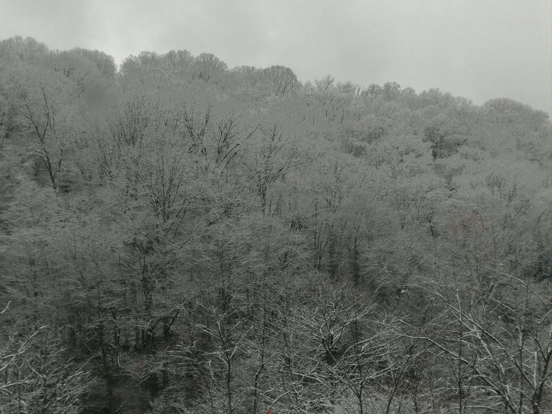
West Virginia is under a Winter Storm Warning from the National Weather Service and a State of Emergency from Gov. Jim Justice.

The entire state of West Virginia is under either a winter weather advisory or a winter storm warning.

“We have got a winter storm warning for much of our forecast area,” Simone Lewis, a meteorologist at the National Weather Service in Charleston, said. “So pretty much the whole state of West Virginia has either got a winter storm warning or a winter weather advisory and that’s for late this evening, lasting through Saturday morning.”

Starting at 7 p.m. on Jan. 18 and lasting through 10 a.m. Saturday morning, Jan. 20 heavy snow is expected with a possible accumulation of four to 12 inches, depending on the region.

“We are expecting a general four to six inches, and that includes down in the southern coalfields also. And then once you get into the mountainous counties, we’re expecting eight to 12 inches,” Lewis said.

Gov. Jim Justice declared a state of emergency for all 55 West Virginia counties ahead of the storm on Thursday afternoon. The State of Emergency allows state agencies to coordinate ahead of a possible weather event, including by pre-positioning personnel, vehicles, equipment and other assets.

“All West Virginians need to absolutely be ready for the potential impact this winter storm may bring to our state,” Justice said. “West Virginians should pay extra close attention to emergency officials and media outlets, and be prepared if there are power outages. West Virginians take care of one another, so make sure you check on your neighbors and loved ones, too.”

The wind chill is expected to be 16 degrees on Friday before it drops to -2 degrees on Saturday morning. Lewis said by Saturday, the heaviest accumulations will generally be over with.

“It’d be probably about mid to late evening and lasting through much of the day Friday,” Lewis said. “Saturday, the system will start to pull off to the east, but we will continue to see some lingering light snow shower activity across the state.”

The West Virginia Emergency Management Division (WV EMD) has been placed on standby to support the State Emergency Operations Center should the need arise.

EMD has posted non-emergency numbers for each county 911 center.

The West Virginia Division of Highways (WVDOH) crew continues their snow removal and ice control operations. 

“We are prepared for any snowfall event, whether it’s an inch of snow or a foot of snow,” said Joe Pack, P.E., WVDOH chief engineer of District Operations. “We attack each storm with the same level of importance of having every available truck on the road, with a driver in it, plow mounted on it, and salt in the back.”

Statewide, WVDOH has a stockpile of more than 231,000 tons of salt. A typical snowplow holds 12 tons of salt, enough to treat about 100 lane miles of road.

Winter Storm Brings Dangerous Conditions To The Region

Record cold and winter weather will be moving into the region over the next several days. Communities across the state are preparing to help the most vulnerable.

Record cold and winter weather will move into the region over the next several days. Communities across the state are preparing to help the most vulnerable.

National Weather Service Meteorologist Fred McMullen said the state is in for a trifecta of wind, snow, and a flash freeze as temperatures drop more than 30 degrees into the single digits overnight into Friday.

“There’s a concern for very icy conditions to develop very quickly, right around seven to nine [degrees] in the morning,” McMullen said.

He said wind has the potential to not only bring dangerous wind chills to the region, but also damage.

“Friday through Saturday night, we’re going to see wind chills not climb above zero until probably Christmas afternoon. So you’re looking at a period of, depends on where you live, 48 to 60 hours of sub zero wind chills consistently,” McMullen said. “We’re looking at wind sustained between 20 and 30 miles an hour with gusts of 45 to 55 miles an hour. We’re worried about downed trees, large branches and then also scattered power outages as well.”

Rev. Zac Morton of the First Presbyterian Church in Morgantown works with the mutual aid group Morgantown RAMP, a grassroots volunteer organization advocating for shelter in the community.

“[Mutual aid] it’s just a vocabulary word for a really simple concept of people pooling their time, energy and resources together to meet a need that’s noticed in the community,” he said. “We have kind of a collective responsibility to care for folks who are having kind of the hardest time that often fall through the cracks.”

Morton said the organization has distributed resources like tents to the unhoused population, but Morton said the extreme cold is dangerous.

“It’s the question of once you get cold, can you warm up again?” Morton said. “That’s really the main situation that we’re trying to avoid is people who get stuck in a position, in an environment where they are cold and can’t get warm again, and you get hypothermic, and I mean there’s a whole host of things that can happen.”

Morton said RAMP works with Morgantown’s warming shelter at Hazel’s House of Hope, which has already had more than 30 community members using it consistently. RAMP is also using grant money from United Way to ensure everyone has a place to get out of the cold.

“If people don’t fit particularly well into that collective warming shelter, for instance, we have seen quite a few families that come through, they’re better served by a hotel option,” Morton said. “Or people who have a health or medical condition, where they need to be kind of isolated to be able to take care of themselves, we have the hotel as a secondary option.”

Call or text 211 for help locating a warming shelter in your community.

State Of Emergency Declared Ahead Of Winter Weather

Gov. Jim Justice has declared a State of Emergency for all 55 West Virginia counties due to the winter storm forecast to hit the state in the coming days.

Gov. Jim Justice has declared a State of Emergency for all 55 West Virginia counties due to the winter storm forecast to hit the state in the coming days.

The National Weather Service predicts heavy snow, freezing rain, dangerous wind chills, and strong winds beginning Thursday, Dec. 22, 2022, and continuing throughout the week and into the coming holiday weekend.

Justice had already declared a State of Preparedness on Tuesday in anticipation of the storm.

The State of Emergency allows state agencies, including the Emergency Management Division, the National Guard and the Division of Highways to coordinate ahead of a possible weather event, including by pre-positioning personnel, vehicles, equipment and other assets.

Justice urged West Virginians to be ready for the potential impacts of the storm.

“West Virginians should pay extra close attention to emergency officials and media outlets, and be prepared if there are power outages,” he said. “West Virginians take care of one another, so on this holiday weekend, make sure you check on your neighbors and loved ones.”

State Of Preparedness Declared Ahead Of Winter Weather

Gov. Jim Justice declared a State of Preparedness for all 55 counties in West Virginia Tuesday due to the winter storm event forecast to hit the state.

Gov. Jim Justice declared a State of Preparedness for all 55 counties in West Virginia Tuesday due to the winter storm event forecast to hit the state.

The National Weather Service predicts heavy snow, freezing rains, dangerous wind chills, and strong winds beginning Wednesday, Dec. 21, 2022, continuing throughout the week and into the coming holiday weekend.

The state Emergency Operations Center and its partner agencies are directed to prepare to respond to the impending winter storm, posturing personnel and resources to respond quickly should an emergency develop.

Justice and the Emergency Management Division ask all West Virginians to remain attentive to weather conditions through local media reports and follow any instructions issued by emergency officials.

Deadline Nears To Apply For Storm Loans In 5 W.Va. Counties

Small private nonprofit organizations in five West Virginia counties have a few more weeks to apply for federal loans for economic losses from several winter storms last February.

The U.S. Small Business Administration said Feb. 14 is the filing deadline for the Economic Injury Disaster Loans from storms on Feb. 10 to 16, 2021. Eligible counties are Cabell, Lincoln, Mason, Putnam and Wayne.

Types of organizations eligible include food kitchens, homeless shelters, museums, libraries, community centers, schools, colleges and others.

The loans are offered to help the organizations meet needs such as ongoing operating expenses.

To apply online, visit DisasterLoanAssistance.sba.gov/ela/s under SBA declaration #16982, not for the COVID-19 incident.

Winter Storm Blanketing Parts Of South With Snow, Ice

A winter storm blanketed parts of the South with snow, freezing rain and sleet Thursday, tying up roads in Tennessee and Kentucky as the system tracked a path through Appalachia toward the Mid-Atlantic and Northeast.

Nashville saw 6.3 inches (16 centimeters) of snowfall on Thursday, shattering the city’s previous Jan. 6 record of 4 inches (10 centimeters) that had stood since 1977, the National Weather Service said. Freezing rain and sleet coated areas around the Tennessee-Alabama state border, said Scott Unger, a meteorologist for the service in Nashville.

Authorities urged people to travel only when necessary, as Metro Nashville Police reported accidents and other driving woes that snarled and slowed several roads. Police in the city reported dozens of wrecks on the road by the early afternoon. A bevy of crashes and other issues bottlenecked drivers on multiple interstates in the region.

Along the Kentucky border, authorities in Montgomery County, Tennessee, were dealing with dozens of crashes as well, including a wreck that killed one person involving a commercial vehicle on Interstate 24, according to Tennessee Highway Patrol spokesperson Lt. Bill Miller.

Tennessee Department of Transportation regional spokesperson Rebekah Hammonds tweeted Thursday that the agency is “clearing as much as we can but issues will continue as snow continues to fall and temps drop.”

With temperatures expected to plummet overnight, everything on the ground is going to freeze and create treacherous road conditions Friday, Unger said.

Schools around Tennessee canceled classes and governments temporarily closed their buildings, as far west as Memphis and Shelby County, which saw a dose of ice and snow. Gov. Bill Lee shuttered state offices across Tennessee. Nashville and Memphis both saw their share of canceled flights.

Kentucky Gov. Andy Beshear warned that the snow hitting his state was “both real and dangerous,” with hundreds of car crashes across the state. Some areas had already received more than a half-foot by early afternoon, National Weather Service meteorologist Ron Steve said. Beshear declared a state of emergency and said he deployed teams of the Kentucky National Guard to help in the response, particularly at interstate closures. Search and rescue teams were activated for safety checks on stranded motorists.

Beshear closed state offices at noon Thursday and later extended the closure through Friday.

The largest snowfall by Thursday evening was 8 to 9 inches (20 to 23 centimeters) in a swath from Elizabethtown to Bardstown and Nicholasville to Lexington, said meteorologist Brian Schoettmer of the weather service’s Louisville office. Eastern Kentucky recorded 6 to 8 inches (15 to 20 centimeters), and far western Kentucky had about 3 inches (8 centimeters).

In Elizabethtown, officials said a pileup of 20 to 30 cars in snowy conditions Thursday afternoon closed both lanes of the Western Kentucky Parkway.

Kentucky transportation officials said the snow fell so fast that by the time they finished plowing some routes, they were already snow-covered again.

First lady Jill Biden, meanwhile, had to cancel her trip planned for Thursday to view damage from last month’s tornado in Bowling Green, Kentucky.

The storm presented an expected boon to the ski industry in West Virginia, where up to 9 inches (23 centimeters) of snow was forecast. Three of the state’s four major downhill ski resorts had suspended on-slope operations earlier this week due to warmer conditions. Now the activity was picking back up.

“West Virginia can’t wait to welcome travelers to our snow-capped mountains this winter,” said Chelsea Ruby, secretary of the state’s Department of Tourism.

The storm’s path could create further headaches as it swirls through the Mid-Atlantic and the Northeast.

In Virginia, work was under way both to prepare for the expected snow and mitigate the effects of a winter storm earlier in the week that left hundreds of drivers stranded on Interstate 95.

Gov. Ralph Northam declared a state of emergency and tapped the Virginia National Guard for some additional help.

The Washington and Baltimore areas, parts of central and southern Maryland, and portions of northern Virginia should expect 2 to 4 inches (5 to 10 centimeters) of snow overnight Thursday into Friday morning, with isolated high amounts up to 6 inches (15 centimeters), forecasters said. The Office of Personnel Management said federal offices in the Washington area would be closed Friday.

Massachusetts was bracing for 8 inches (20 centimeters) or more from 2022’s first snowstorm, and as a precaution, many state workers were told to stay home Friday. Gov. Charlie Baker also urged residents to either work from home or use public transportation so highways were free of traffic and could be easily cleared.

From late Thursday through Friday afternoon, 4 to 7 inches of snow were expected in parts of central and southern New Hampshire, and south-central and southwest Maine, according to the weather service. The highest amounts are expected along the coast. The steadiest snow will be expected during the morning commute Friday before tapering off.

In Michigan, meanwhile, snow fueled by the Great Lakes fell for a second consecutive day Thursday in the western part of the state and the Upper Peninsula, with some communities reporting remarkable amounts and bracing for even more by Friday.

Ishpeming recorded 23 inches (58 centimeters) in one location, while many other areas in the Upper Peninsula had a foot or more, the National Weather Service said.

In North Dakota, dangerously frigid weather presented the biggest risk Thursday. Cold temperatures enveloping the state pushed wind chill readings down to minus 59 degrees in Bowbells, the county seat of Burke County in northwestern North Dakota.

Exit mobile version