The state’s western counties are under an excessive heat watch through the end of the week.
The National Weather Service expects heat and humidity to move into the Mid-Ohio Valley Thursday and Friday.
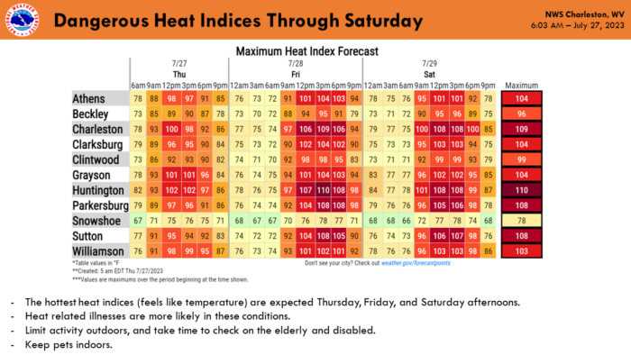
This may result in heat index values above 100 degrees, posing a danger for heat related illnesses. The heat index combines both air temperature and relative humidity into a single value of how hot the weather will feel.
Francis Kredensor, lead meteorologist with the National Weather Service in Charleston, said there may be some variability in the coming days, but high heat is all but assured for the region.
“It’s still a little bit of a question just how high it will be, but we’re pretty confident on at least the 100-degree heat index readings, and a good chance that we’ll be above 105 in a lot of spots,” he said.
According to the National Oceanographic and Atmospheric Administration, a heat index between 90 degrees to 103 degrees requires extreme caution. Heat stroke, heat cramps or heat exhaustion are possible with prolonged exposure or physical activity.
Kredensor reminds people to take it easy, especially those with health sensitive on heat issues, and to over exert yourself in any outdoor activity if avoidable.
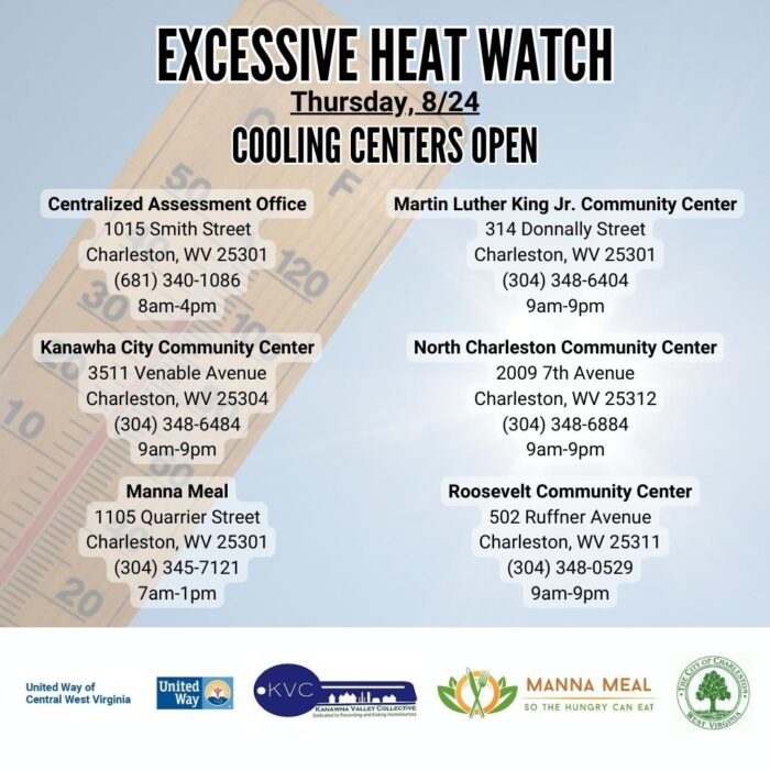
United Way of Central West Virginia has announced it will open cooling centers across Charleston on Thursday.
The extreme heat is expected to be short-lived as cooler air moves into the region Friday evening.
“It doesn’t look like the front itself has a lot of storms forecast to be associated with it, but definitely it could have some storms,” Kredensor said. “The bigger thing will just be getting some cooler and somewhat drier air in from the north and northwest.”