
Your browser doesn't support audio playback.
Summer heat is still a preoccupation for most. But some state officials are already looking forward to the fall.
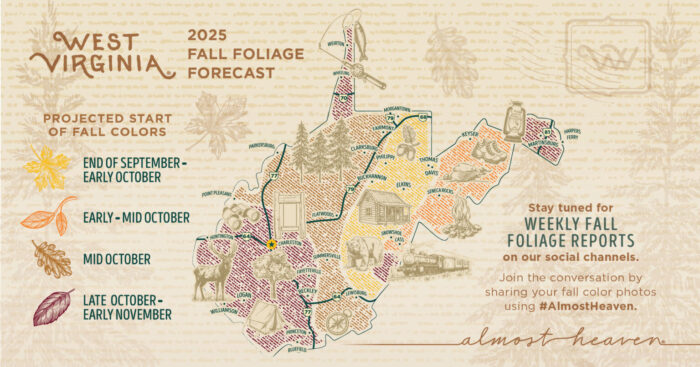
The West Virginia Department of Tourism, in partnership with the Division of Forestry, last week unveiled its fall foliage projection map. The map predicts when and where fall foliage will appear across the state, helping travelers plan autumn trips to the third most forested state in the U.S.
In a press release, tourism officials say that West Virginia’s high summer rainfall totals have set the stage for exceptional color this season.
“West Virginia’s mountains are poised to put on one of their most breathtaking shows yet,” West Virginia Division of Forestry Director Jeremey Jones wrote. “With the wet summer and perfect mix of warm days and crisp nights, we’re expecting vibrant reds, brilliant oranges, and golden yellows to sweep across the hillsides this fall.”
The Allegheny Highlands region from Morgantown to Lewisburg will be the first to see changing colors by the end of September, followed by the Eastern Panhandle in early October.
Starting mid-September, the Department of Tourism will highlight some of the best destinations and adventures for enjoying vibrant color.