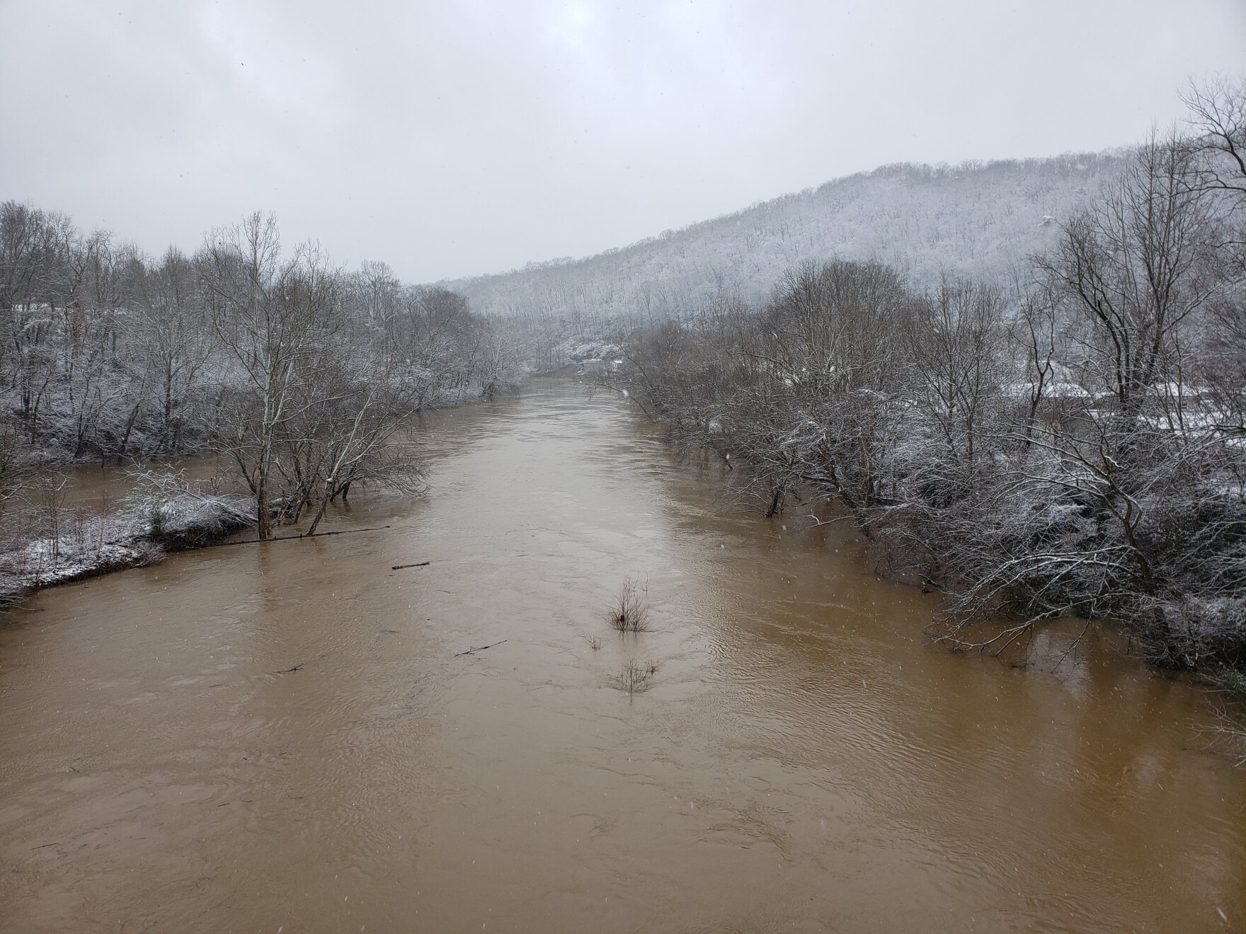
From the recent ice and snow storms, to the flooding rains followed by sunny 70 degree days, the state has seen some wild weather swings recently.
Kevin Law is a Marshall University professor and West Virginia state climatologist. He also created the meteorology program at Marshall, teaching students to be weather forecasters and broadcasters.
Eric Douglas spoke with Law to find out why we’re seeing such extreme changes in weather.
This interview has been lightly edited for clarity.
Douglas: I’m sure the biggest question you get right now is what’s going on with the weather?
Law: A lot of it we have to trace back to the jet stream. The jet stream is that swift-moving current of air in their upper levels that divides cold air to the north from warm air to the south. Back in the middle of February, there was a big dip in the jet stream. That extended right into the central part of the United States. It was a big trough of cold air that extended down to Texas. That’s why Texas experienced some extremely cold temperatures. In fact, I believe Dallas had a low temperature of -2 degrees one morning, which was the second coldest temperature they’ve actually ever experienced. You have to go back to 1899 to see a colder temperature than that.
So there was a really deep, cold trough in the central part of the U.S. Here in West Virginia, we were just slightly to the east of that trough. So our temperatures weren’t quite as cold as what you saw there in Texas. There was just enough warm air in the middle levels that was going over top of some cold air at the surface. And that is the recipe for ice and freezing rain and sleet.
Douglas: I’ve read recently that there are some people who are suggesting that the jet stream itself is weakening and wild swings and weather are likely to continue in the end to get worse in coming years.
Law: I’ve seen research that if the jet stream slows down, or weakens, there’s more wobbling or more north-south amplitude changes in the jet stream. So you have deeper colder troughs, but also warmer, higher ridges. So that would explain the variability that we see. It might be cold one week, but then you give it a few days and we have jumped to the warm side of it.
Douglas: Do you see that as something we need to prepare for?
Law: I’ve definitely seen more variability for sure. When you look at cold waves from 40-50 years ago, when it got cold, it tended to stay cold for an extended period. One of the best examples is the winters back in 1977 and 1978. It stayed cold most of the month of January. We’ve had cold weather recently, and even a few years back, back in 2014 or 2015 when we had temperatures that were almost as cold as what we saw back in the ‘70s.
The difference is the duration. Yes, we have these cold spells, but then it gets warm, then it gets cold again, and then it gets warm. I think back to January 2014. We had some extremely cold temperatures, but we also had some warm temperatures that same month. Back in the late ‘70s. You didn’t see that variability.
Douglas: West Virginia is relatively fortunate in that we’re in a temperate climate to begin with so we’re not subject to the wild swings of temperature. We’re probably seeing wetter weather here and hotter, but definitely wetter. What’s the future hold?
Law: When you look at the two major variables, temperature and precipitation, the one that stands out the most here in West Virginia is an increase in precipitation. If you were to break it down by season, we seem to have a little bit more precipitation, even in the fall, when usually the fall is the driest time of the year.
But when we have increases in precipitation in the fall, that can really play out throughout the rest of the year. I think back to a couple of years ago; September 2019 was extremely dry. We had drought-like conditions throughout a lot of the state. But then all of a sudden in October, things just flipped and went the other way and we had extremely wet conditions. How can we have a record precipitation and at the same time have a drought that same year?
Douglas: Can you give me a quick definition of La Niña versus El Niño.
Law: We have to look at the ocean temperatures right off the coast of Peru in South America. Whenever those water temperatures are warmer than normal, we call that an El Niño. Whenever they’re colder than normal, that’s a La Niña. Right now the temperatures are colder than normal along the coast of Peru. So that’s a La Niña and those colder or warmer than normal water temperatures will then impact jet stream, which is what we’ve been talking about here today.
Douglas: Is this what we refer to as as climate change?
Law: Well, some of this is tied to that. You mentioned El Niño and La Nina. We’re actually in La Niña now and La Niña is generally responsible for increased precipitation, especially in the Ohio Valley. When you combine colder temperatures with increased precipitation, that translates to snow and various forms of winter precipitation, and that’s why the middle of February was like that.
Douglas: One of the big stories that came out of the big storm from a couple of weeks ago was how ill-prepared Texas was for the extremely cold temperatures. How does West Virginia prepare?
Law: I definitely think we need to look at our infrastructure. If you think back to 2012, we had the Derecho that showed how vulnerable we are when it comes to big storms and how the grid and the power lines are very susceptible to violent storms. So we need to take that into consideration. We need to get those power lines in better condition to withstand stronger storms.
Douglas: It may be anecdotally, but I feel like we’re seeing more tornadoes, earlier. We’re seeing more hurricanes earlier in the season and later in the season. I assume that’s all tied together as well.
Law: We are in La Niña year and that was very similar to what we saw in 2011 when we also had a pretty cold winter, especially in the central part of the United States. So if we were to look at this coming spring, we might actually see more tornadoes in the central part of the United States, largely because we are coming out of wintertime cold temperatures.
As the temperature starts to rebound in the spring, as we get to have 70, maybe even 80 degree days at the ground, the upper-level temperatures are going to still be cold. Whenever you have warm surface temperatures, and cold upper-level temperatures, that sets up tornadoes, so we might anticipate a least increase in tornado activity this spring.